
About the E5, the route, how we planned our hike
And what we packed.
The E5 Trail
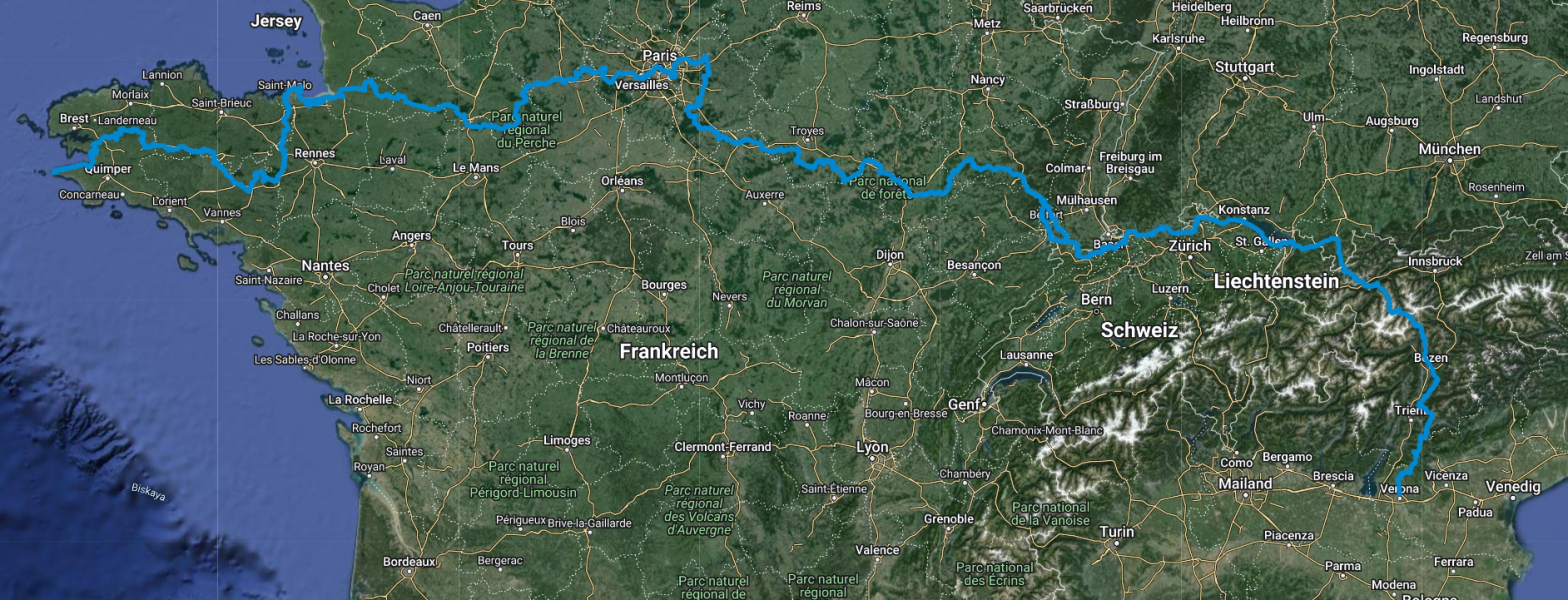
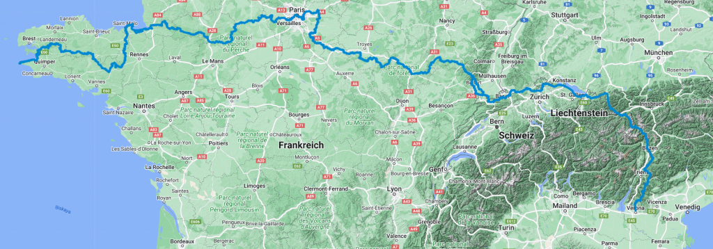
When we decided to hike the E5 European long-distance hiking trail a few weeks ago, the reaction we mostly got from friends was: “Oh, that’s super cool and where does it go?” But some die-hard hiking fans were familiar with it and then the reaction was: “Ah, it goes from Oberstdorf to Merano, doesn’t it?” Part of the E5 does indeed run from Oberstdorf to Merano over the Alps, but that is only part of it. The entire E5 starts at Pointe du Raz in France and then runs through France via Mont Saint Michel and Paris to the Swiss border, entering Switzerland via Basel. The route then continues along the Rhine to Lake Constance, from where it reaches the Allgäu region via Bregenz and cover almost 50 kilometres in Germany via Sonthofen and Oberstdorf to the Alps. The route then crosses the Alps via the Braunschweiger Hütte, Zams and a section of the Pitztal valley through Austria and finally reaches Italy via the South Tyrolean Alps, Merano and Bolzano, where the E5 ends in Verona.
We first came across the E5 trail on a map published by KOMPASS Verlag, which lists all 12 European long-distance hiking trails and provides an overview of youth hostels along the way. Funnily enough, my parents gave it to me as a birthday present last year. 🙂 It helps to get a rough overview, but not for more detailed planning or even orientation.
So the first thing Matthäus and I did for our planning was to browse through the internet to see what we could find about the E5. I’ve listed a few useful sources below. Our conclusion, however, was that there is very little to be found on the E5 as a whole, but a huge number of descriptions, reports, books, blogs and other sources on crossing the Alps on the E5.
The best overview of the entire E5 can be found on the official website of the European Ramblers Association (ERA). For each of the five countries through which the E5 runs, it describes exactly which signposted hiking trails it follows and which places or sights it passes through.
The best GPX track, which also largely corresponds to the description on the ERA website, can be found on Waymarked Trails, although the track is partially incomplete.
Because all the sources only provide a rough overview of the overall route and no information on planning the stages, I used Komoot for more detailed planning. Here you can find the link to my account, where you can find the stages as we roughly plan them. However, this is still work in progress and we will adapt the stages over time depending on how well we progress, where we find accommodation and what the paths are like.
For more precise planning, I have planned the route from the marked trails of the respective hiking associations. In France, for example, long-distance hiking trails are Grand Randonnées (GR) with different numbers, such as GR37. You can find information about the route of these hiking trails on GR-Infos pages, for example. Or you can also use the ‘Geoportail’ app, where we discovered that all (French) hiking trails are mapped in great detail. However, I must also issue a warning at this point: Sometimes the markings/routes on the different pages don’t match and where the markings are actually placed is one of those things. Just to give you an example: We started laying out our route along the GR37 a few days ago and there were already different variants for the section between Huelgoat and Carhaix, one via the ‘Vallee du saints’. Suddenly, two days later, it was no longer on Iphygenie, although it was listed there beforehand. “You’ve seen it too, haven’t you?” Matthäus asks me, “I’m beginning to doubt my sanity!” Ironically, the path has disappeared just as we had planned to take it.
For the part of the E5 from Constance to Verona, i.e. the famous section over the Alps, we use the established stage planning as described in the “Rother Wanderführer, E5 Konstanz-Verona” (in German).
You can see the stages we actually do on my Strava account and, of course, on this blog.
Accomodations
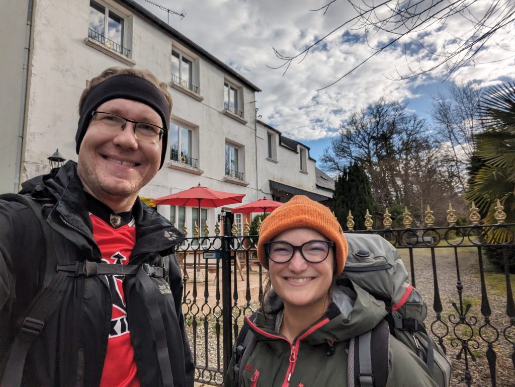
We thought about it for a long time and finally decided to go without a tent etc. and only stay in accommodations along the way. As the route does not pass through totally deserted areas, this is no problem and so far we have had very positive experiences with the French gites, hotels, hostels and bed and breakfasts. In the mountains, we will spend the nights in mountain huts with sleeping bags.
What we have packed
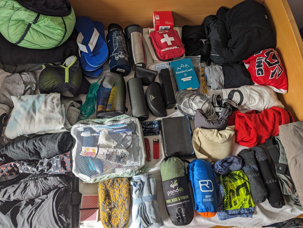
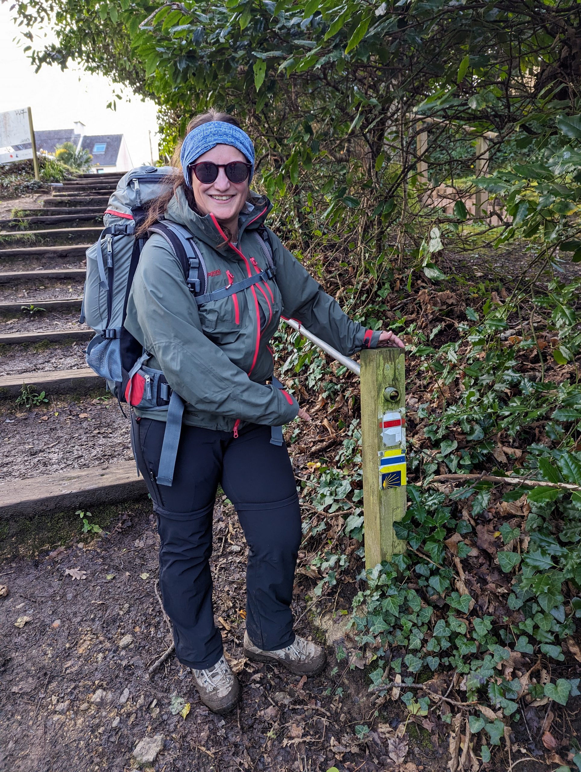
Of course, ‘less is more’ when hiking – especially when you’re travelling on foot for several weeks at a time. That’s why we only packed two sets of hiking clothes and one set of dry clothes for the evenings and otherwise only things that you need when hiking such as a pocket knife, head torch (we’ve actually already used it – I’m not proud to say…) and blister plasters. You can find a more detailed list below if you’re interested. Basically, we tried to limit our weight per rucksack to 6kg and (almost) succeeded!

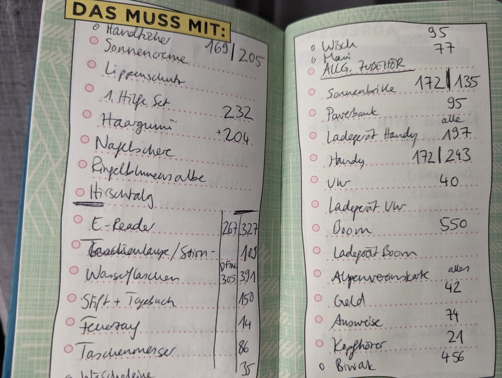
| Was? | Gewicht Marie | Gewicht Matthäus |
| Rucksack | 1600 | 2500 |
| Clothes | 1538 | 1271 |
| Washing bag | 1223 | 1052 |
| Elektronics | 1098 | 883 |
| Other things | 990 | 1148 |
| Total | 6449 | 6854 |
| Total in the RUCKSACK | 4849 | 4354 |
Sources E5:
- Official website of the European Ramblers’ Association ERA on the E5: https://www.era-ewv-ferp.org/e-paths/e5/
- Waymarked Trails: https://hiking.waymarkedtrails.org/#route?id=300393&map=5.0/47.2401/3.3513
- Traildino: https://www.traildino.com/trace/continents-Europe/countries-European_Trails/trails-E5
- Alpenverein Austria: https://www.alpenverein.at/weitwanderer/weitwanderwege/fernwanderwege/E5.php
- For the E5 part from Constance to Verona: “Rother Wanderführer, E5 Konstanz-Verona”
- Our Komoot Planning: https://www.komoot.de/user/755442462415?ref=amk
- Out actual hikes: https://strava.app.link/scfWu7DSXHb